Click to visit the main New York Public Library Homepage
The New York Public Library
Digital Collections
About Digital Collections
Browse
Search only public domain materials
Items
Collections
Divisions
Home
Search
Browse
About
Search only public domain materials
Items
Collections
Divisions
Digital Collections
Using Images
Using Data
Search
Filtered search
Show filters
Hide filters
Show Only Public Domain
topic
Nautical charts
7
Harbors
3
Coasts
2
Navigation
2
Bays
1
More
Less
name
x
Ackerman, James, 1815 or 1816-1864
United States Coast Survey
10
Bache, A. D. (Alexander Dallas), 1806-1867
9
Bradley, S. W. (Engraver)
3
Boutelle, C. O. (Charles Otis)
2
More
Less
collection
Maps of North America
11
I. N. Phelps Stokes Collection of American Historical Prints
1
place
Massachusetts
4
Atlantic Ocean
2
Atlantic Coast
1
Atlantic Coast (S.C.)
1
Atlantic Coast (U.S.)
1
More
Less
genre
Maps
11
Nautical charts
5
Bathymetric maps
3
Illustrations
1
Prints
1
More
Less
publisher
U.S. Coast Survey
8
U.S. Coast Survey Office
2
Government Printing Office
1
division
Map Division
11
Wallach Division: Print Collection
1
type
cartographic
11
still image
2
Date Range
to
12 results found
Filtering on:
x
Name
: Ackerman, James, 1815 or 1816-1864
Sort by:
Title
Date created
Date digitized
Sequence
Chicago harbor
Reconnaissance of the S.E. en…
Preliminary chart of Monomoy …
Preliminary chart of the sea …
Savannah River, reconnaissanc…
Sketch F, showing the progres…
Preliminary chart of Stellwag…
Sketch B: showing the progres…
Reconnaissance of the eastern…
Tidal currents of Nantucket S…
Preliminary chart of Gloucest…
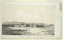
Fort Bridger, Black's Fork of…
End of results
|
Top