Click to visit the main New York Public Library Homepage
The New York Public Library
Digital Collections
About Digital Collections
Browse
Search only public domain materials
Items
Collections
Divisions
Home
Search
Browse
About
Search only public domain materials
Items
Collections
Divisions
Digital Collections
Using Images
Using Data
Search
Filtered search
Show filters
Hide filters
Show Only Public Domain
topic
Anglo-French War, 1793-1802
1
Atlases, British
1
Caribbean Americans
1
Clothing & dress
1
Clothing & dress -- To 999
1
More
Less
name
Bell, A. (Andrew), 1728-1779
1
Gouverneur & Kemble
1
Moll, Herman, -1732
1
collection
Gouverneur & Kemble letter book
1
Lawrence H. Slaughter Collection of English maps, charts, globes, books and atlases
1
Map of the Old Continent exhibiting its greatest diametrical length from the point of East Tartary to the Cape of Good Hope
1
Wallach Division Picture Collection
1
place
x
Europe
West Indies
2
Africa
1
Asia
1
Caribbean Area
1
More
Less
genre
Maps
2
Correspondence
1
Prints
1
letter books
1
publisher
And sold by him [Herman Moll], over-against Devereux-Court, between Temple-Bar and St. Clements's-Church in the Strand,
1
s.n
1
division
Manuscripts and Archives Division
1
Map Division
1
Schomburg Jean Blackwell Hutson Research and Reference Division
1
Wallach Division: Picture Collection
1
type
cartographic
2
still image
1
text
1
Date Range
to
4 results found
Filtering on:
x
Note
: A. L. S. Endorsed: "Letter from Col. Atlee Augt. 1776." 1 page. 8o
x
Place
: Europe
Sort by:
Title
Date created
Date digitized
Sequence
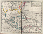
A map of the West-Indies &c. …
Map of the Old Continent exhi…
m
Gouverneur & Kemble letter bo…
Costumes of the Franks from t…