Click to visit the main New York Public Library Homepage
The New York Public Library
Digital Collections
About Digital Collections
Browse
Search only public domain materials
Items
Collections
Divisions
Home
Search
Browse
About
Search only public domain materials
Items
Collections
Divisions
Digital Collections
Using Images
Using Data
Search
Filtered search
Show filters
Hide filters
Show Only Public Domain
topic
x
Canals
Administrative and political divisions
1
Altitudes
1
Charts, diagrams, etc
1
Drainage
1
More
Less
name
E. & H.T. Anthony (Firm)
2
Barnard, William S., approximately 1809-
1
Clark, John E
1
Currier, Charles, 1818-1887
1
Douglass, David Bates, 1790-1849
1
More
Less
collection
Maps of New York City and State
3
Robert N. Dennis collection of stereoscopic views
2
place
x
New York (State)
Brooklyn (New York, N.Y.)
2
Catskill Mountains (N.Y.)
2
Delaware and Hudson Canal (N.Y. and Pa.)
2
New York
2
More
Less
genre
Maps
3
Photographs
2
Stereographs
2
publisher
City Corporation?,
1
Gaylord Watson
1
Lith. of R.H. Pease
1
New York State Engineer and Surveyor?
1
division
Map Division
3
Wallach Division: Photography Collection
2
type
cartographic
3
still image
2
Date Range
to
5 results found
Filtering on:
x
Note
: Inscribed "to S. Watson from Johns Fergusson."
x
Place
: New York (State)
x
Topic
: Canals
Sort by:
Title
Date created
Date digitized
Sequence
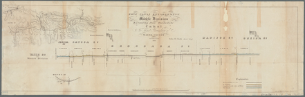
Erie Canal enlargement, middl…
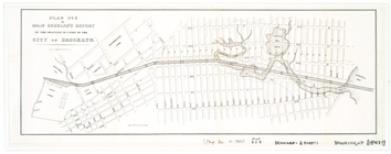
Plan[s] of Majr. Douglas's re…
m
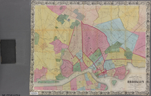
Watson's new map of the city …
m
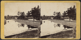
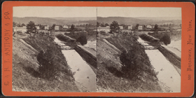
The Delaware and Hudson Canal…
m
The Delaware and Hudson Canal…