Click to visit the main New York Public Library Homepage
The New York Public Library
Digital Collections
About Digital Collections
Browse
Search only public domain materials
Items
Collections
Divisions
Home
Search
Browse
About
Search only public domain materials
Items
Collections
Divisions
Digital Collections
Using Images
Using Data
Search
Filtered search
Show filters
Hide filters
Show Only Public Domain
topic
x
Nautical charts
Trade routes
3
Trade winds
3
Coasts
1
name
Bowen, Emanuel, d. 1767
2
Cooper, Thomas, d. 1743
2
Bowen, Emanuel, 1693 or 1694-1767
1
Herbert, William, 1718-1795
1
Sayer, Robert, 1725-1794
1
More
Less
collection
Maps of the Oceans
2
John H. Levine Collection
1
Maps of North America
1
place
x
North Atlantic Ocean
Early works to 1800
2
Maps
2
Atlantic Coast (North America)
1
Maritime Provinces
1
More
Less
genre
Maps
4
publisher
Printed and sold by Wm. Herbert under the Piazzas on London Bridge & Robt. Sayer facing Fetter Lane, Fleet Street
1
Publish'd ... & sold by T. Cooper at the Globe in Pater noster Row,
1
Publish'd according to Act of Parliament, for the London Magazine
1
T. Cooper
1
division
Map Division
4
type
cartographic
4
Date Range
to
4 results found
Filtering on:
x
Note
: Inscribed "to S. Watson from Johns Fergusson."
x
Place
: North Atlantic Ocean
x
Topic
: Nautical charts
Sort by:
Title
Date created
Date digitized
Sequence
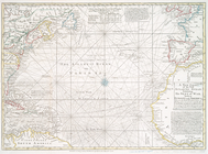
An actual survey of the sea c…
A new chart of the vast Atlan…
A new chart of the vast Atlan…
A new chart of the vast Atlan…