Click to visit the main New York Public Library Homepage
The New York Public Library
Digital Collections
About Digital Collections
Browse
Search only public domain materials
Items
Collections
Divisions
Home
Search
Browse
About
Search only public domain materials
Items
Collections
Divisions
Digital Collections
Using Images
Using Data
Search
Filtered search
Show filters
Hide filters
Show Only Public Domain
topic
x
Indians of North America
Dwellings
7
Railroads
5
Hopi Indians
3
Indian reservations
3
More
Less
name
Downs, Frank E., 1857-1946
3
Keeler, W. J. (William J.)
3
Underwood & Underwood
3
A.R. Ohman Map Co
2
Bolton, Reginald Pelham, 1856-1942
2
More
Less
collection
Robert N. Dennis collection of stereoscopic views
12
Maps of North America
9
Frank E. Downs. Trip to Nome, Alaska, May to Sept. 1900: An album of mounted photographs
3
Detroit Publishing Company postcards
2
Emmet Collection of Manuscripts Etc. Relating to American History
2
More
Less
place
Colorado
4
Mesa Verde National Park (Colo.)
4
Montezuma County (Colo.)
4
United States, West
4
West (U.S.)
4
More
Less
genre
Photographs
17
Maps
12
Stereographs
12
Prints
5
Portraits
2
More
Less
publisher
Keystone View Company
4
Detroit Publishing Company
2
Museum of the American Indian, Heye Foundation
2
W.J. Keeler
2
A. Bertrand
1
More
Less
division
Wallach Division: Photography Collection
16
Map Division
12
Milstein Division
3
Wallach Division: Print Collection
3
Rare Book Division
2
More
Less
type
still image
26
cartographic
11
text
2
Date Range
to
37 results found
Filtering on:
x
Note
: Inscribed "to S. Watson from Johns Fergusson."
x
Rights
: Public Domain
x
Topic
: Indians of North America
Sort by:
Title
Date created
Date digitized
Sequence
John Wright, Tobacconist, 15 …
The northwesterly part of the…
Southern part of the borough …
A compleat map of North-Carol…
Einfahrt des Hafens von New Y…
Map no. 1 from San Francisco …
Map showing the routes travel…
Nevves From America ... , [Fr…
The Sacramento Valley from th…
m
National map of the territory…
m
National map of the territory…
m
National map of the territory…
A map of a portion of the Ind…
Dodge expedition route map fr…
The generall historie of Virg…
Osceola's Grave, Fort Moultri…
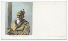
An Honest Indian - Old John B…
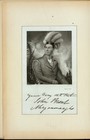
Your very obediant John Brant…
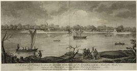
A view of St. John's, upon th…
m
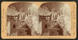
Chief of the Kachina dance at…
m
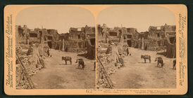
South side of Wolpi, a Moki r…
m
The plaza, "Pueblo" of Mishon…
m
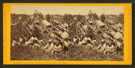
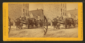
On carts, from Pembina, on Re…
m
Ox carts, from Pembina, on Re…
m
View from Acoma.
m
Old Pueblo Indian and Spanish…
m
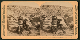
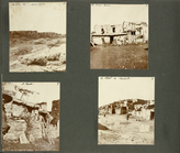
Headquarters on Lake Tule, ta…
m
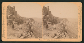
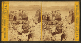
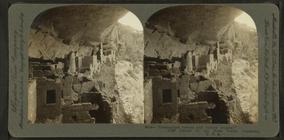
Dismantled towers, and turret…
m
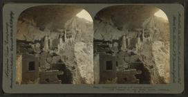
Dismantled towers, and turret…
m
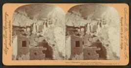
Dismantled towers, and turret…
m
Dismantled towers, and turret…
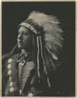
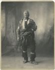
John Hollow Horn Bear, Sioux
John Maskwas, Pottawatomie
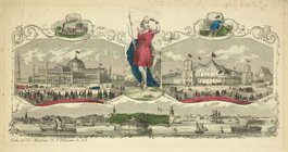
View of New York from the sou…
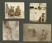
Photographs from Frank Teeter…
Photographs from Frank Teeter…
Photographs from Frank Teeter…
End of results
|
Top