Click to visit the main New York Public Library Homepage
The New York Public Library
Digital Collections
About Digital Collections
Browse
Search only public domain materials
Items
Collections
Divisions
Home
Search
Browse
About
Search only public domain materials
Items
Collections
Divisions
Digital Collections
Using Images
Using Data
Search
Filtered search
Show filters
Hide filters
Show Only Public Domain
topic
x
Real property
Fire insurance
86
Cities & towns
81
Landowners
27
Business enterprises
12
More
Less
name
Sanborn Map Company
84
Ullitz, Hugo
39
E.B. Hyde & Co
38
E. Belcher Hyde Map Company
33
G.W. Bromley & Co
32
More
Less
collection
Atlases of New York City
180
Atlases of the United States
125
Maps of New York City and State
20
Maps of North America
16
Collection of broadside real estate maps announcing auctions of lots in early 19th century New York City
5
More
Less
place
New York (State)
309
New York
107
Brooklyn (New York, N.Y.)
68
Genesee County (N.Y.)
30
Maps
24
More
Less
genre
Maps
307
Atlases
125
Cadastral maps
30
Title pages
20
Prints
14
More
Less
publisher
Sanborn Map Company
81
E. Belcher Hyde
33
F. W. Beers & Co
22
G.W. Bromley & Co
22
Fairchild, John F
17
More
Less
division
Map Division
337
Milstein Division
10
No Division
1
Schomburg Jean Blackwell Hutson Research and Reference Division
1
type
cartographic
320
text
31
still image
4
Date Range
to
349 results found
Filtering on:
x
Note
: Inscribed "to S. Watson from Johns Fergusson."
x
Rights
: Public Domain
x
Topic
: Real property
Sort by:
Title
Date created
Date digitized
Sequence
m
Maps of property in the city …
m
Map of property belonging to …
Map of portion of greater New…
m
To the honourable House of Re…
m
Map of 45 lots of ground leas…
m
Map of a water grant between …
Executors sale of valuable re…
m
Map & plan of the contemplate…
Map & plan of the contemplate…
A compleat map of North-Carol…
Map of a portion of Point Ke…
Map of the Iron Cliffs Co.'s …
Map of a portion of the Salem…
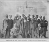
Directors of the New Rochelle…
Georgia, parish of St. John :…
A compleat map of North-Carol…
Land given to the town of Qui…
Map of building lots, on the …
m
Map of Tolland County, Connec…
Map of the province of New Yo…
m
Map of Cayuga and Seneca Coun…
Map of the eastern townships …
m
Coll. John Bryerly's draught …
m
James Freese's mapp of his lo…
m
John Biddle's survey of 472 a…
m
John Biddle's survey of 219 a…
m
Isaac Watson resurvey, 1724 (…
Map no. III : [to accompany A…
Map showing the old farms : f…
Map of the village of Hermann…
Village of Livingston's Landi…
m
Map of the city of Brooklyn, …
Map of Morris's Purchase or W…
Troy, N.Y., from actual survey
Map of property situated in t…
Map of 150 lots of ground sit…
m
Map of the original grants of…
m
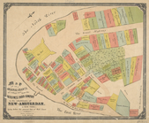
Map of New York City from Bat…
m
Map showing the high and low …
m
Beers' new map of Staten Isla…
m
Map of the City of New York n…
Map of John W. Decker's house…
Map of property belonging to …
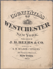
County atlas of Westchester, …
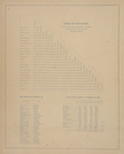
Table of Distances. ; Post Of…
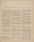
Illustrated historical atlas …
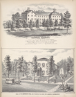
Residence of S.W. Mason, Esq.…
Oakwood Seminary; Res. of O.E…
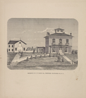
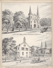
View of Holy Family Church fr…
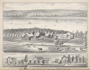
West Farm Building of David B…
1
2
Previous
Next
1
2
Previous
Next