Click to visit the main New York Public Library Homepage
The New York Public Library
Digital Collections
About Digital Collections
Browse
Search only public domain materials
Items
Collections
Divisions
Home
Search
Browse
About
Search only public domain materials
Items
Collections
Divisions
Digital Collections
Using Images
Using Data
Search
Filtered search
Show filters
Hide filters
Show Only Public Domain
topic
History
25
Maps
20
Indians of North America
15
Colonies
13
World maps
13
More
Less
name
Moll, Herman, -1732
19
Carey, Mathew, 1760-1839
17
Kitchin, Thomas, 1718-1784
16
Blaeu, Willem Janszoon, 1571-1638
14
Jefferys, Thomas, -1771
14
More
Less
collection
Lawrence H. Slaughter Collection of English maps, charts, globes, books and atlases
219
Maps of North America
207
Maps of New York City and State
38
John H. Levine Collection
36
Maps of North and South America
11
More
Less
place
North America
141
Maps
89
United States
73
America
72
Early works to 1800
71
More
Less
genre
Maps
542
Early maps
8
Facsimiles
8
Early works to 1800
5
Aerial views
3
More
Less
publisher
s.n
32
s.n.,
15
Presso Antonio Zatta
12
publisher not identified
8
J. Hinton
6
More
Less
division
Map Division
532
Schomburg Jean Blackwell Hutson Research and Reference Division
10
Rare Book Division
1
type
cartographic
543
still image
1
text
1
Date Range
to
543 results found
Filtering on:
x
Note
: Relief shown pictorially.
Sort by:
Title
Date created
Date digitized
Sequence
Insulae Moluccae celeberrimae…
Representation la plus nouvel…
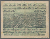
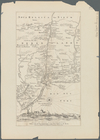
Jamaica, Long Island, N.Y
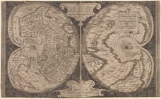
World map on double cordiform…
Amerika ĕst nor Ashkharhagrak…
A map of the world from the b…
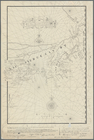
Boston Harbor
Map of the frontiers of the n…
m
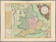
Le royaume d'Angleterre: divi…
Carte de la Nouvelle France a…
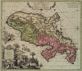
The state of South Carolina :…
East Florida : from surveys m…
Map of New Netherland with a …
Lines of the Paterson, Passai…
An exact map of New Jersey, P…
A new and accurate map of eas…
m
Georgia from the latest autho…
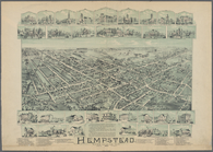
Hempstead, Long Island, N.Y.
Leavitt's map with views of t…
The province of Maine: from t…
Balloon view of Narragansett …
Map of the southern parts of …
An Accurate map of New Hampsh…
m
A map of the most inhabited p…
m
A map of the most inhabited p…
A map of New England, and Nov…
m
Map of the states of North Ca…
The Province of Maine, from t…
A map of part of the Province…
New Hampshire & Vermont
Map of New England
m
A map of the most inhabited p…
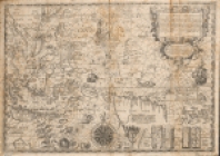
Nieu Nederlandt
The state of Connecticut: inc…
Van Der Donck's map of New Ne…
Map of Livingston Manor anno …
A new and accurate map of the…
Map of the Nipmuck or Nipnet …
Map of the village of Rochest…
A mappe of Colonel Römers voy…
A mappe of Colonel Römers voy…
Geological section from the M…
Profile shewing the general f…
Connecticut and parts adjacent
A new and accurate map of Con…
A plott of ye situations of t…
The south part of New-England…
Part of North America, contai…
The isle of California, New M…
Map of Massachusetts, Connect…
1
2
3
Previous
Next
1
2
3
Previous
Next