Click to visit the main New York Public Library Homepage
The New York Public Library
Digital Collections
About Digital Collections
Browse
Search only public domain materials
Items
Collections
Divisions
Home
Search
Browse
About
Search only public domain materials
Items
Collections
Divisions
Digital Collections
Using Images
Using Data
Search
Filtered search
Show filters
Hide filters
Show Only Public Domain
topic
x
Streets
Ferries
5
Piers
3
Railroads
3
Fills (Earthwork)
2
More
Less
name
C.S. Hammond & Company
1
Dripps, M. (Matthew)
1
Dripps, M.(Matthew)
1
Pleasants Finder Map Company
1
Rand McNally and Company
1
More
Less
collection
Maps of New York City and State
4
Photographic views of New York City, 1870's-1970's, from the collections of the New York Public Library
1
place
x
New York
New York (State)
5
New York (N.Y.)
4
Manhattan (New York, N.Y.)
3
Brooklyn (New York, N.Y.)
2
More
Less
genre
Maps
4
Photographs
1
publisher
C.S. Hammond and Co
1
M. Dripps
1
The Company
1
publisher not identified
1
division
Map Division
4
Milstein Division
1
type
cartographic
4
still image
1
Date Range
to
5 results found
Filtering on:
x
Place
: New York
x
Topic
: Streets
x
Topic
: Ferries
Sort by:
Title
Date created
Date digitized
Sequence
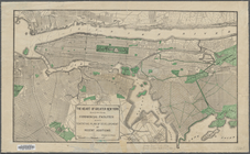
Brooklyn and vicinity
m
Topographical map of New York…
m
Street guide of Manhattan and…
m
Queens: Beach 189th Street.
The heart of greater New York…