Click to visit the main New York Public Library Homepage
The New York Public Library
Digital Collections
About Digital Collections
Browse
Search only public domain materials
Items
Collections
Divisions
Home
Search
Browse
About
Search only public domain materials
Items
Collections
Divisions
Digital Collections
Using Images
Using Data
Search
Filtered search
Show filters
Hide filters
Show Only Public Domain
topic
x
Subways
Local transit
10
Railroads, Elevated
8
Railroads
5
Ferries
2
More
Less
name
C.S. Hammond & Company
2
A.G. Hagstrom Co
1
Brooklyn Daily Eagle (Firm)
1
Clendening Apartment Hotel
1
General Drafting Company
1
More
Less
collection
Maps of New York City and State
10
place
x
New York
New York (State)
10
New York (N.Y.)
7
Manhattan (New York, N.Y.)
5
Brooklyn
2
More
Less
genre
Maps
10
Road maps
3
Mass transit
2
Aerial views
1
Wall maps
1
publisher
A. Humitsch
1
Brooklyn Daily Eagle
1
C.S. Hammond & Co
1
Clendening Apartment Hotel
1
Hagstrom Map Co
1
More
Less
division
Map Division
10
type
cartographic
10
Date Range
to
10 results found
Filtering on:
x
Place
: New York
x
Topic
: Subways
x
Topic
: Local transit
Sort by:
Title
Date created
Date digitized
Sequence
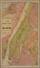
Hammond's complete map of New…
The Brooklyn of the future : …
m
The five boroughs of the city…
m
Hammond's complete map of Bro…
m
Hagstrom's map of upper New Y…
Hagstrom's map of ... New Yor…
m
Hagstrom's map of Queens N.Y.…
m
Authentic street plan of grea…
Rand, McNally & Co.'s new han…
Map of the southern part of t…