Click to visit the main New York Public Library Homepage
The New York Public Library
Digital Collections
About Digital Collections
Browse
Search only public domain materials
Items
Collections
Divisions
Home
Search
Browse
About
Search only public domain materials
Items
Collections
Divisions
Digital Collections
Using Images
Using Data
Search
Filtered search
Show filters
Hide filters
Show Only Public Domain
topic
x
Early maps
Almanacs
1
Colonial cities
1
Fort Moultrie, Battle of, S.C., 1776
1
Voyages and travels
1
name
Bassett, Thomas (Bookseller)
1
Chiswell, Richard
1
Faden, William, 1749-1836
1
James, Thomas, -1782
1
Lamb, Francis
1
More
Less
collection
Maps of North America
3
Lawrence H. Slaughter Collection of English maps, charts, globes, books and atlases
1
place
South Carolina
3
North Carolina
2
South Atlantic States
2
United States
2
America
1
More
Less
genre
Maps
4
publisher
And are sold by him: and by J. Hills
1
Engrav'd & Publish'd according to Act of Parliament Augt. 10th, 1776. by Wm. Faden, Corner of St. Martins Lane Charing Cross
1
Philip Lea
1
Sold by Tho. Basset in Fleetstreet and Ric. Chiswell in St. Pauls Churchyard
1
division
Map Division
4
type
cartographic
4
Date Range
to
4 results found
Filtering on:
x
Place term
: London
x
Topic
: Early maps
Sort by:
Title
Date created
Date digitized
Sequence
A new map of Carolina
m
A new description of Carolina
A plan of the attack of Fort …
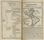
America.