Click to visit the main New York Public Library Homepage
The New York Public Library
Digital Collections
About Digital Collections
Browse
Search only public domain materials
Items
Collections
Divisions
Home
Search
Browse
About
Search only public domain materials
Items
Collections
Divisions
Digital Collections
Using Images
Using Data
Search
Filtered search
Show filters
Hide filters
Show Only Public Domain
topic
x
Administrative and political divisions
Maps
5
Real property
3
Landowners
2
Altitudes
1
More
Less
name
Mitchell, S. Augustus (Samuel Augustus), 1792-1868
5
Balch, E. A
2
Shearer, William Otis
2
Smith, Robert Pearsall, 1827-1898
2
Chace, J
1
More
Less
collection
Maps of New York City and State
9
place
x
New York (State)
New York (N.Y.)
2
Au Sable Forks
1
Au Sable Forks (N.Y.)
1
Chester (N.Y.)
1
More
Less
genre
Maps
9
Cadastral maps
2
publisher
S. Augustus Mitchell
3
E.A. Balch & W.O. Shearer
1
L.E. Preston & Co
1
Published by S. Augustus Mitchell
1
Published by S. Augustus Mitchell, No. 8 1/2 South Seventh Street
1
More
Less
division
Map Division
9
type
cartographic
9
Date Range
to
9 results found
Filtering on:
x
Place term
: Philadelphia
x
Place
: New York (State)
x
Topic
: Administrative and political divisions
Sort by:
Title
Date created
Date digitized
Sequence
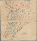
Map of the manors erected wit…
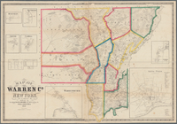
Map of Warren Co., New York
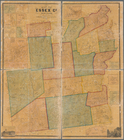
Map of Essex Co., New York
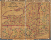
Mitchell's county and townshi…
The Empire State, New York : …
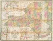
Map of the state of New York …
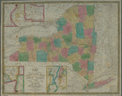
Map of the state of New York …
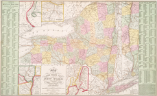
Map of the state of New York …
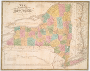
Map of the state of New York